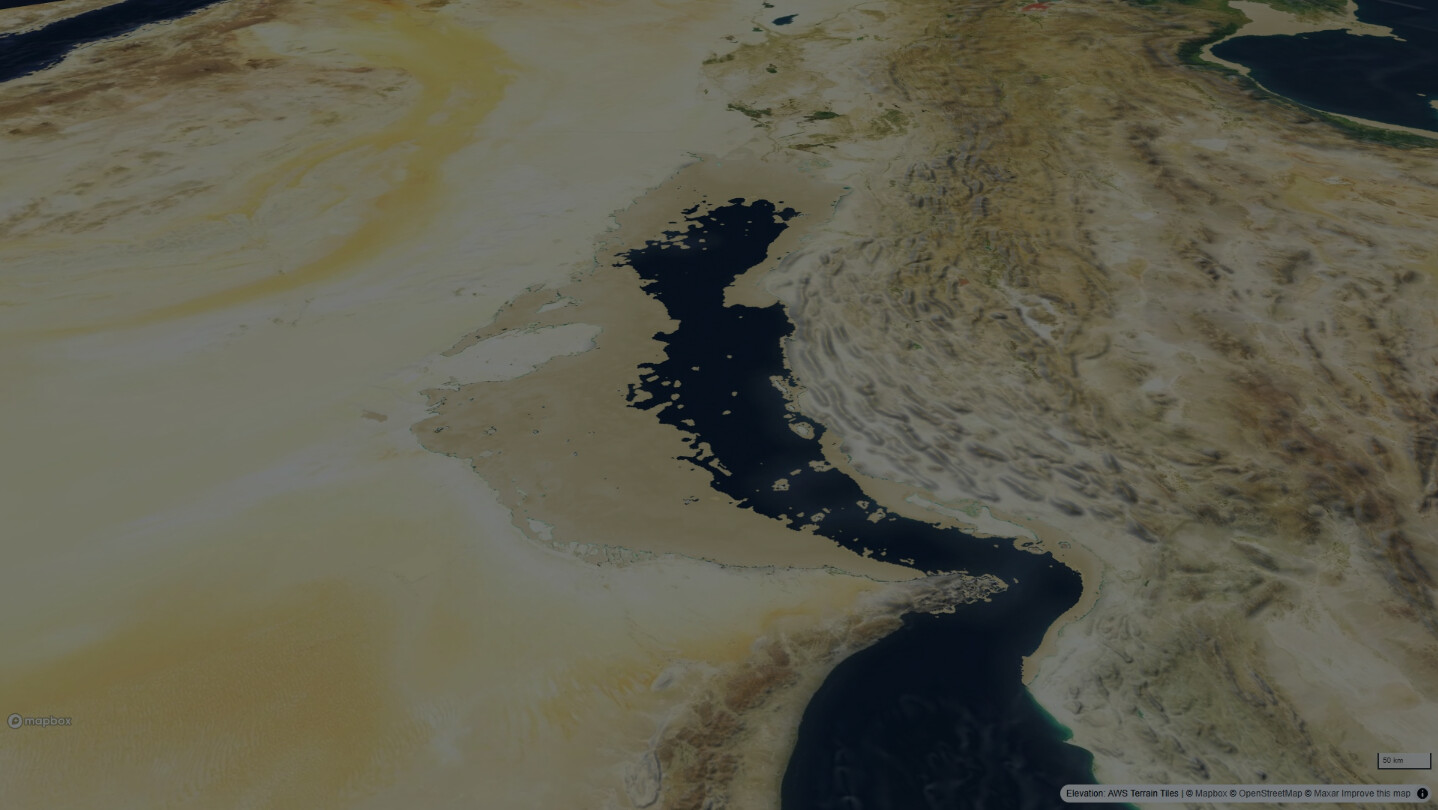


Rain on real terrain and watch the rivers run. Drain the oceans to the Ice Age and the Persian Gulf becomes a valley. Roll the atlas back to 3000 BC, then send a caravan across what remains. An educational sandbox on real elevation data, with its sources on every layer.

Войдите, чтобы добавить этот продукт в список желаемого или скрыть его

Не поддерживается русский язык

Этот продукт не поддерживает ваш язык. Пожалуйста, перед покупкой ознакомьтесь со списком поддерживаемых языков.

Эта игра ещё не доступна в Steam

Скоро выйдет

Заинтересовала игра?
Добавьте её в список желаемого и получите уведомление, когда она выйдет
 

Об этой игре

Watershed is an educational sandbox for real terrain. Draw an area anywhere on Earth, pick a storm, and watch real elevation data fill its valleys, carve rivers and run to the sea, live on your graphics card. Then drain the oceans back to the Ice Age, roll the atlas back to the Bronze Age, and send a caravan across what remains.

Weather

Six storm presets with their real order of magnitude, from a desert cloudburst to a monsoon week, or set every number yourself. Turn the rain up until the valley floors become lakes, then ease it off and watch them drain. Cloud shadows, rain and lightning play over readable ground, and a procedural soundscape follows the water.

Ocean

Lower or raise the world sea level from 500 m below today to 80 m above, on real bathymetry. The Persian Gulf drains into a river valley, Dover joins Calais, deltas drown.

Time

An atlas from 3000 BC to today: cities take their old names, peoples and empires move, roads appear and vanish. Every entry cites its source.

Journeys

Place two flags and up to eight stops. A camel or ox caravan walks around the lakes and the sea of the chosen century, fords rivers where it must, stops at wells and cities, and tells you day by day whether the animals would survive.

Honest

Every layer is real, public data with its source shown. Every number has a reason. It is a teaching instrument, not an engineering model, and the app says so.

For classrooms

Share links reproduce a whole scenario, so a teacher can send a class the exact valley, storm, century and route to explore. Two ready 40-minute lesson plans with worksheets are included.

Made by Mozon, a one-person studio in Dubai. Requires an internet connection for map and terrain data.

Информация об ИИ-контенте

Вот как разработчики описывают контент в игре, сгенерированный ИИ:

Parts of the source code and some store and marketing text were written with help from AI coding assistants during development. All terrain, water simulation, satellite imagery and map data come from real geographic datasets. No AI-generated artwork, audio or narrative ships with the app, and nothing is generated during play.

Системные требования

    Минимальные:
    • 64-разрядные процессор и операционная система
    • ОС: Windows 10 or 11, 64-bit
    • Процессор: Any 64-bit CPU from the last eight years
    • Оперативная память: 4 GB ОЗУ
    • Видеокарта: Any GPU with WebGPU support (roughly the last six years); integrated chips run at reduced detail
    • Место на диске: 200 MB
    • Дополнительно: Broadband internet connection required for map and terrain data. Uses the Microsoft Edge WebView2 runtime (installed automatically).
    Рекомендованные:
    • 64-разрядные процессор и операционная система
    • ОС: Windows 11, 64-bit
    • Процессор: Quad-core CPU
    • Оперативная память: 8 GB ОЗУ
    • Видеокарта: Dedicated GPU (GeForce GTX 1060 / Radeon RX 580 or newer)
    • Место на диске: 500 MB
    • Дополнительно: Broadband internet connection required for map and terrain data.
Фильтры обзоров